Race Street Historic District

Last Updated 4/20/2026Posted in Historic Districts

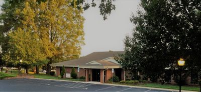
The South Race Street Historic District lies on the southwest side of Statesville, and is a densely developed community of houses, churches, and neighborhood stores associated with the manufacturing and rail corridor which skirts the southern edge of the district. Bordering to the east and north are the Mitchell College Historic District and the Academy Hill Historic District.

Well-preserved and largely intact, the historic district is comprised of 84 contributing resources and 38 non-contributing ones. The non-contributing resources include small, brick houses and low-scale apartments from the post-World War II era as well as older buildings which have lost integrity through alterations and additions.

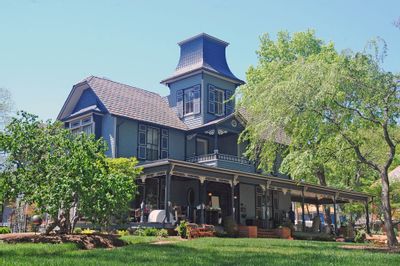
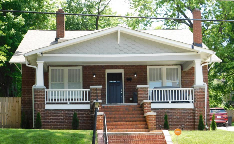
Developed initially during the pre-automobile era, the houses tend to be set on narrow lots, close to the street. The district is a mixture of both large, two story houses and smaller, worker housing. A number of the more substantial, stylish dwellings are found on South Race Street. The larger homes are generally sited on corner lots. The streets within the district are lined with tree lined planting strips.

Residential construction predominated in the area. Houses are found on the east-west West Sharpe, West Bell and Armfield streets and Western Avenue as well as on the north-south Oak and South Race streets. The earliest houses date from 1894 to the turn of the century, and a number of these survive on South Race Street and West Sharpe Street and one at the corner of Armfield and South Race streets.

South Race Street Historic District Map

South Race Street Historic District Survey (completed in 1995)


Garfield/Green Street National Historic District Celebra... On Friday, June 19, residents, neighborhood leaders, elected officials, City staff, community partners, and visitors gathered in the Gar...
The North Carolina Drought Monitor map, updated June 18, 2026, shows worsening drought conditions across much of the state. Large portions of central and northern North Carolina are shaded red and dark red, indicating extreme (D3) and exceptional (D4) drought conditions. Much of the remainder of the state is experiencing severe drought (D2), shown in orange, with smaller areas of moderate drought (D1) in tan. According to the North Carolina Drought Management Advisory Council, City of Statesville water customers remain under D2 severe drought conditions, and water restrictions remain in effect. The map includes drought classifications and data from the USDA, National Drought Mitigation Center, NOAA, and partner agencies.
City of Statesville Moves to Stage 2 Water RestrictionsThe City of Statesville is currently under Stage 3 (Extreme Drought) conditions. Beginning at 8 a.m. on May 4, 2026, the City will enfor...
Residents Invited to Review Draft Beverly Heights/Wester... The City of Statesville invites residents, property owners, and business owners in the Beverly Heights and Western Heights area to atten...
Front & Center: Keeping You Informed of City of Statesvi... Weekly updates from the desk of April Nesbit, Public Information Officer for the City of Statesville. Continue reading for updates for t...
CANCELLED: Statesville Historic Preservation Commission ...
Jun 25, 2026
7:00 PM EDT
227 S. Center Street.
Statesville, NC 28677
Read More 
Board of Adjustment Meeting
Jul 07, 2026
12:30 PM EDT
Statesville, NC
Read More 
Statesville Regional Airport Commission Meeting
Jul 08, 2026
12:00 PM EDT
227 S. Center Street.
Statesville, NC 28677
Read More 
Statesville African American Heritage Preservation Commi...
Jul 08, 2026
6:00 PM EDT
227 S. Center Street.
Statesville, NC 28677
Read More