Mitchell College Historic District

Last Updated 6/3/2025Posted in Historic Districts

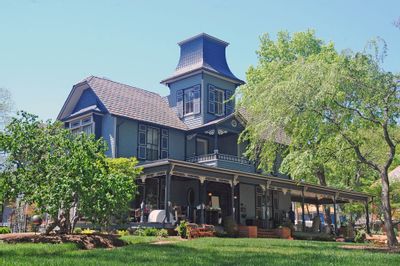
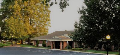
The Mitchell College Historic District is a highly concentrated area of primarily late nineteenth and early twentieth century structures located just west of the Statesville Commercial Historic District. Although most of the 200-plus buildings are residential in nature, the district also includes Mitchell Community College, the two oldest religious structures remaining in Statesville, one of the earliest cemeteries in Iredell County, and several other non-residential structures of interest.

Mitchell College serves as the focal point of the district, with the other buildings arranged along tree-shaded streets surrounding it. Taking up all or part of twenty city blocks, Mitchell College District is by far the largest of the four historic districts in Statesville. Mitchell College neighborhood was composed of families of the middle and upper social and economic classes. The houses and other buildings in the district generally display a fairly high quality of design with numerous architectural periods represented. Approximately 60% of the homes in the district are two story, framed structures. Very few of the home use other materials, such as brick veneer, stucco-covered masonry and rusticated concrete blocks.

Mitchell College Historic District Map

1980 Mitchell College Historic District Survey

2002 Amened Mitchell College Historic District Survey
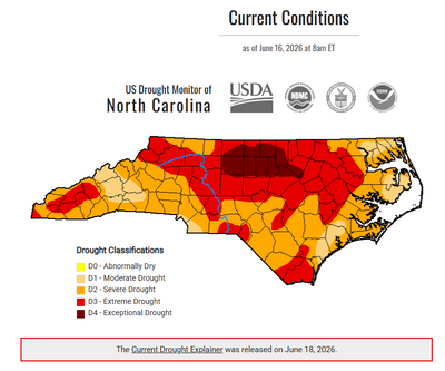

The North Carolina Drought Monitor map, updated June 18, 2026, shows worsening drought conditions across much of the state. Large portions of central and northern North Carolina are shaded red and dark red, indicating extreme (D3) and exceptional (D4) drought conditions. Much of the remainder of the state is experiencing severe drought (D2), shown in orange, with smaller areas of moderate drought (D1) in tan. According to the North Carolina Drought Management Advisory Council, City of Statesville water customers remain under D2 severe drought conditions, and water restrictions remain in effect. The map includes drought classifications and data from the USDA, National Drought Mitigation Center, NOAA, and partner agencies.
City of Statesville Remains at Stage 2 Water RestrictionsThe City of Statesville has reduced its water shortage response level to Stage 2 following improved drought conditions and guidance from...
An orange utility marker and exposed service line stand beside a neighborhood sidewalk, indicating underground utility or infrastructure work in progress. A quiet residential street lined with trees and well-kept lawns stretches into the distance on a sunny day.
Fiber Optic Installation Planned in the Cloaninger Avenu... The City of Statesville has approved a Right-of-Way Encroachment Permit for Ripple Fiber to install underground fiber optic conduit and ...
City of Statesville Invites Community to Celebrate at St... The City of Statesville invites residents and visitors to celebrate the stories, traditions, and cultures that have shaped our community...
Front & Center: Keeping You Informed of City of Statesvi... Weekly updates from the desk of April Nesbit, Public Information Officer for the City of Statesville. Continue reading for updates for t...
CANCELLED: Statesville Historic Preservation Commission ...
Jul 23, 2026
7:00 PM EDT
227 S. Center Street.
Statesville, NC 28677
Read More 
Statesville ABC Board Meeting
Jul 28, 2026
11:00 AM EDT
Statesville, NC
Read More 
Statesville Housing Authority Meeting
Jul 28, 2026
5:30 PM EDT
110 West Allison Street
Statesville, NC 28677
Read More 
Statesville Planning Board Meeting
Jul 28, 2026
6:00 PM EDT
227 S. Center Street.
Statesville, NC 28677
Read More